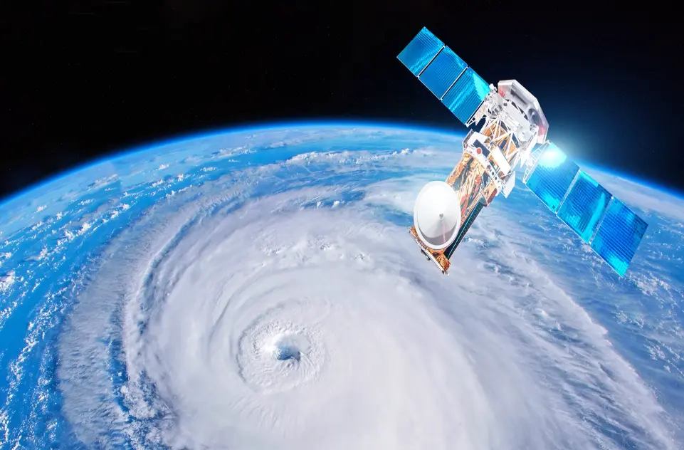
A weather satellite is an advanced orbiting spacecraft designed to observe and monitor Earth’s atmospheric conditions, weather patterns, and climate dynamics. Equipped with high-resolution cameras, infrared sensors, and other instruments, it captures real-time data on cloud formations, storm systems, temperature variations, wind speeds, and ocean currents. Positioned in geostationary or polar orbits, these satellites provide continuous imagery and measurements that meteorologists use to forecast weather, track hurricanes and typhoons, detect wildfires, and monitor environmental changes. By delivering accurate, global perspectives, weather satellites enhance disaster preparedness, aviation safety, and agricultural planning, playing a vital role in understanding and responding to our planet’s ever-changing climate.
Table of contents
- Part 1: OnlineExamMaker AI quiz generator – The easiest way to make quizzes online
- Part 2: 20 weather satellite quiz questions & answers
- Part 3: Try OnlineExamMaker AI Question Generator to create quiz questions
Part 1: OnlineExamMaker AI quiz generator – The easiest way to make quizzes online
Are you looking for an online assessment to test the weather satellite knowledge of your learners? OnlineExamMaker uses artificial intelligence to help quiz organizers to create, manage, and analyze exams or tests automatically. Apart from AI features, OnlineExamMaker advanced security features such as full-screen lockdown browser, online webcam proctoring, and face ID recognition.
Take a product tour of OnlineExamMaker:
● Includes a safe exam browser (lockdown mode), webcam and screen recording, live monitoring, and chat oversight to prevent cheating.
● AI Exam Grader for efficiently grading quizzes and assignments, offering inline comments, automatic scoring, and “fudge points” for manual adjustments.
● Embed quizzes on websites, blogs, or share via email, social media (Facebook, Twitter), or direct links.
● Handles large-scale testing (thousands of exams/semester) without internet dependency, backed by cloud infrastructure.
Automatically generate questions using AI
Part 2: 20 weather satellite quiz questions & answers
or
1. Question: What is the primary purpose of weather satellites?
Options: A) To monitor ocean currents; B) To observe and predict weather patterns; C) To study distant planets; D) To transmit radio signals
Answer: B
Explanation: Weather satellites are equipped with sensors to capture data on atmospheric conditions, helping meteorologists forecast weather accurately.
2. Question: Which type of orbit is most commonly used by weather satellites for global coverage?
Options: A) Low Earth Orbit (LEO); B) Geostationary Orbit (GEO); C) Polar Orbit; D) Highly Elliptical Orbit
Answer: B
Explanation: Geostationary Orbit allows satellites to remain over the same spot on Earth, providing continuous monitoring of weather systems.
3. Question: What kind of data do weather satellites primarily collect?
Options: A) Seismic activity; B) Atmospheric temperature and humidity; C) Volcanic eruptions; D) Wildlife migration patterns
Answer: B
Explanation: Satellites use instruments like radiometers to measure temperature, humidity, and cloud cover, essential for weather forecasting.
4. Question: Which organization launched the first weather satellite?
Options: A) European Space Agency (ESA); B) National Aeronautics and Space Administration (NASA); C) Russian Space Agency; D) Japan Aerospace Exploration Agency (JAXA)
Answer: B
Explanation: NASA’s TIROS-1, launched in 1960, was the first satellite dedicated to weather observation.
5. Question: How do weather satellites help in tracking hurricanes?
Options: A) By measuring wind speeds on the ground; B) By providing real-time images of storm development; C) By predicting earthquake impacts; D) By monitoring animal behavior
Answer: B
Explanation: Satellites capture infrared and visible images that track the eye and intensity of hurricanes as they form and move.
6. Question: What is the approximate altitude of a geostationary weather satellite?
Options: A) 100 km; B) 36,000 km; C) 500 km; D) 1,000 km
Answer: B
Explanation: At about 36,000 km above Earth’s equator, these satellites match the planet’s rotation, staying fixed relative to the surface.
7. Question: Which instrument on a weather satellite is used to detect cloud tops?
Options: A) Radar; B) Spectrometer; C) Infrared Sensor; D) GPS Receiver
Answer: C
Explanation: Infrared sensors measure the temperature of cloud tops, helping to determine storm severity and altitude.
8. Question: What role do polar-orbiting weather satellites play?
Options: A) Providing detailed views of the poles; B) Monitoring global weather multiple times a day; C) Transmitting entertainment signals; D) Exploring asteroids
Answer: B
Explanation: These satellites pass over the poles, scanning the entire Earth and offering frequent updates on weather changes.
9. Question: How often do geostationary satellites provide images?
Options: A) Once a week; B) Every few minutes; C) Once a month; D) Every hour
Answer: B
Explanation: They can send images as frequently as every 5-15 minutes, allowing for real-time weather monitoring.
10. Question: What is the GOES satellite series primarily used for?
Options: A) Military surveillance; B) Weather observation in the Americas; C) Lunar exploration; D) Ocean mapping
Answer: B
Explanation: The Geostationary Operational Environmental Satellite (GOES) series, operated by NOAA, focuses on weather and environmental monitoring for North and South America.
11. Question: Why are weather satellites important for agriculture?
Options: A) To predict crop yields; B) To provide data on rainfall and soil moisture; C) To monitor pest invasions; D) To automate farming equipment
Answer: B
Explanation: Satellites supply data on precipitation and temperature, which farmers use to make decisions about planting and irrigation.
12. Question: What type of radiation do weather satellites use to penetrate clouds?
Options: A) Visible light; B) Microwave radiation; C) Ultraviolet rays; D) X-rays
Answer: B
Explanation: Microwave instruments can see through clouds to measure precipitation and sea surface temperatures.
13. Question: Which satellite system is known for providing global weather data from Europe?
Options: A) Meteosat; B) Landsat; C) SPOT; D) Aqua
Answer: A
Explanation: The Meteosat series, operated by EUMETSAT, delivers weather imagery and data for Europe and Africa.
14. Question: How do weather satellites contribute to climate change studies?
Options: A) By tracking carbon emissions; B) By monitoring long-term atmospheric changes; C) By studying solar flares; D) By mapping urban growth
Answer: B
Explanation: They collect data on trends like global temperatures and ice cover, aiding in climate research and modeling.
15. Question: What is the main limitation of geostationary satellites?
Options: A) Poor resolution; B) Inability to view polar regions; C) High cost of launch; D) Short lifespan
Answer: B
Explanation: These satellites remain over the equator, so they cannot effectively monitor the poles without additional systems.
16. Question: Which band of the electromagnetic spectrum is commonly used by weather satellites for imaging?
Options: A) Radio waves; B) Infrared; C) Gamma rays; D) Cosmic rays
Answer: B
Explanation: Infrared imaging allows satellites to detect heat signatures, useful for night-time and cloud analysis.
17. Question: What does the acronym “NOAA” stand for in the context of weather satellites?
Options: A) National Ocean and Atmospheric Administration; B) New Orbital Astronomical Agency; C) North American Observation Alliance; D) Network of Oceanic Analysis
Answer: A
Explanation: NOAA operates key weather satellites like GOES, focusing on oceanic and atmospheric research.
18. Question: How do weather satellites assist in disaster management?
Options: A) By predicting stock market changes; B) By providing early warnings for floods and storms; C) By coordinating emergency calls; D) By mapping road networks
Answer: B
Explanation: Real-time data from satellites helps authorities issue timely alerts for natural disasters, saving lives.
19. Question: What is the typical resolution of images from modern weather satellites?
Options: A) 1 meter; B) 1 kilometer; C) 100 meters; D) 10 kilometers
Answer: C
Explanation: Many satellites achieve resolutions around 100 meters or better, allowing detailed observation of weather features.
20. Question: Which country’s space agency operates the INSAT weather satellite series?
Options: A) United States; B) India; C) China; D) Brazil
Answer: B
Explanation: The Indian Space Research Organisation (ISRO) uses INSAT satellites for meteorological services and communication.
or
Part 3: Try OnlineExamMaker AI Question Generator to create quiz questions
Automatically generate questions using AI